Lajes (Lajes)
Lajes is a civil parish in the municipality of Praia da Vitória, on the Portuguese island of Terceira in the Azores. The population in 2011 was 3,744, in an area of 12.11 km2. It is the second most populous parish in the municipality of Praia da Vitória. It contains the localities Fundões, Caldeira, Canada da Caldeira, Canada das Fontainhas, Canada das Vinhas, Canada do Poço, Lajedo, Lajes, Picão, Rebentão and Santa Rita.
Lajes is best known for being the location of Portuguese Air Force Base No.4, used for military, small inter-island, as well as scheduled and chartered flights from North America and mainland Europe. The U.S. military has a multi-year agreement with the government of Portugal at Lajes Airfield, which is the base for U.S. 65th Air Base Wing (65 ABW).
There is reference to the navigator Pero de Barcelos, who was one of the first settlers in the region, dating to 3 April 1507. Lajes is thought to have been elevated to the status of town in 1515.
The date of the construction of the original church is unknown. It was burned by English privateers in 1587, and destroyed during the 1614 Cáida da Praia earthquake, which caused considerable destruction to Lajes and surrounding parishes.
Owing to natural qualities, Lajes was the preferred residency of rich and noble families, resulting in it being referred to as A Madrid dos Açores ('The Madrid of the Azores'). Many of the estates and lands supported rest of Terceira, thus earning the epithet Celeiro da Terceira (the 'breadbasket of Terceira'). There are several references to the quantity and quality of the produce in the region, including fruit and wine, in addition to silk production. Lajes is located on a vast fertile plain, divided by hedge rows and where many old seigneurial homes still reflect the importance of farming and prosperity of the traditional families of the island. Many of the modern roadways that intersect the parish today were once used by farmers to transport goods, usually using the large Ramo Grande oxen, pulling large carts. Wood would normally be transported, burned to maintain the warmth during the winter, or for cooking bread in earthen ovens. The oxen, the seigneurial homes and agricultural community became known as the Ramo Grande.
Along with Santa Cruz, Lajes also became the site, during and after the Second World War, for British and American forces stationed at Area Base No. 4, supporting progress and providing a dynamic economic innovator for the parish and region.
Map - Lajes (Lajes)
Map
Country - Portugal
 |
 |
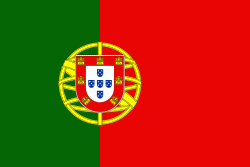
| Flag of Portugal | |
One of the oldest countries in Europe, its territory has been continuously settled, invaded and fought over since prehistoric times. The territory was first inhabited by pre-Roman and Celtic peoples who had contact with Phoenicians, ancient Greeks and Carthaginians. It was later ruled by the Romans, followed by the invasions of Germanic peoples and the Islamic invasion by the Moors, whose rule was eventually expelled during the Reconquista. Founded first as a county of the Kingdom of León in 868, gained its independence as the Kingdom of Portugal with the Treaty of Zamora in 1143.
Currency / Language
| ISO | Currency | Symbol | Significant figures |
|---|---|---|---|
| EUR | Euro | € | 2 |
| ISO | Language |
|---|---|
| PT | Portuguese language |


